
Since we have a bunch of folks who like to mess about with maps in comments: here’s the bigger version (if you’d like to know more about Arcadia, sign up for my Patreon!). It’s absolutely not done yet, so no worries about taking it apart.
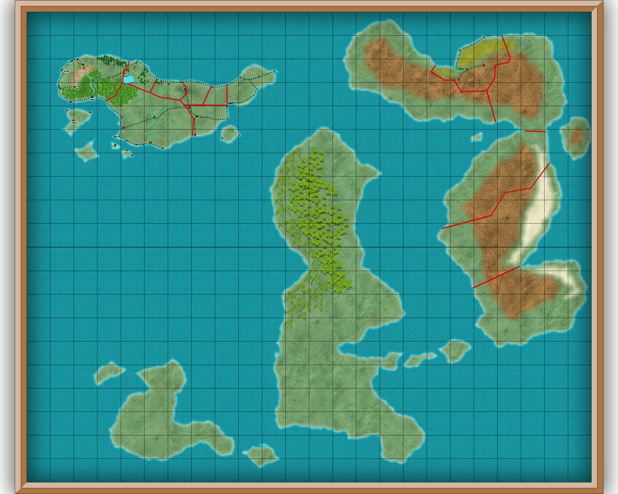
And yes: that continent in the middle is absolutely going to get some monster storms (the sun rises in the west and sets in the east on this planet). That continent up top’s weather is also fairly rainy, albeit at a much less dramatic rate, but the colonists didn’t have many options. Below is a very rough first draft; the ‘Steam Ocean’ in particular is remarkably full of underwater volcanoes. The arctic region is noticeably warmer than the antarctic, in this world.

Moe Lane
PS: I figure that if I get 80% of it right that’s good enough for a game.
Sweet.
.
Assuming a reverse rotation then, then Northwest of Xanadu will be comparatively drier due to both Rain Shadow and a cooler ocean current, kinda like West Australia and Argentina. Assuming that’s what you meant by “up top”, that may have been the more ideal side to settle on the otherwise soaked isle. You’re pretty solid in marking your New Brazilian Rain-forest, as well as your deserts in Thule.
.
As for borders, more aged holdings would have few straight lines, with ridges, rivers and petty inheritance divisions becoming the defining features. Unless, of course, you’re still fresh of settlement like the American west where no one was around yet who cared about those things, and they just threw a grid at it.
The settlement is all of three hundred years old, and they absolutely planned stuff out. They just didn’t realize how sodden the place could be — and the virtual lack of hydrocarbons (Arcadia’s a young world) until well after landfall.
Reference this and reverse the East and West arrows: https://www.bing.com/images/search?view=detailV2&ccid=0NNrpXOm&id=E1899CB941CB26FBD61B1894DEAC918E3137A885&thid=OIP.0NNrpXOmuwwh4vfqro3UjAHaDw&mediaurl=https%3a%2f%2fcloud.mysteryscience.com%2fimage%2ffetch%2fhttps%3a%2f%2fwww.dropbox.com%2fs%2fj6ouxgthvnyo8tc%2fWind%252520Map.png%253Fdl%253D1&exph=1069&expw=2108&q=world+map+prevailing+wind+direction&simid=607992527365867317&selectedIndex=9&ajaxhist=0
Annnd that’s why Southeast Asia gets the monsoons, and not California. Got it.
Also, that’s a damned handy map. Thanks.
Happy to help.